Choose Your Language

Showing posts with label india. Show all posts

Thursday, 1 November 2012

Dead Sea


Dead Sea


Dead Sea is Living as a Wonder of Asia

The Dead Sea is located Israel and the West Bank and Jordan. It is a hypersaline or salt lake that contains more than 8 times the salt present in the ocean waters. Because of this it is often referred to as “Sea of Salt.”
The Dead Sea also represents the lowest place on the surface of the earth. The lowest part of the area reaches down 1,378 feet (420 m) below sea level. The lake itself is 1,247 feet (380 m) making it the deepest hypersaline lake in the world.
The Dead Sea measures 42 miles (67 km) long and 11 miles (18 km) across. The Dead Sea gets water from various sources but the Jordan River is the primary tributary.
The Dead Sea, which shimmers like a bluemirror under all-day sunshine, is one of the most unusual bodies of water in the world.
It is set in the lowest dry land on earth, so it has no outlet. It is so loaded with minerals that no fish can live in it. It is so dense that bathers can lie back on its surface and read a newspaper.
The Dead Sea is located about 25km east ofJerusalem, along the border between Israel and Jordan. About half of it is actually in Jordanian territory.
The ancient Hebrews called this body of water the Sea of Salt. Other ancient names include the Sea of Solitude, the Sea of Arabah and the Asphalt Sea. TheCrusaders called it the Sea of Satan.
The Dead Sea’s therapeutic qualities attracted Herod the Great. Its minerals and sticky black mud provided balms for Egyptian mummies and cosmetics for Cleopatra.
Now its health resorts treat psoriasis and arthritis, its skin-care products are marketed worldwide, and its industrial evaporation pans harvest potash and other minerals.

Evaporation concentrates the minerals


The Dead Sea is 67km long, 18km across at its widest point, and 420 metres below sea level.
Because it has no exit, water is lost only through evaporation, which leaves behind the minerals. The Dead Sea is nearly 10 times assalty as the open seas. The high concentration of minerals (predominantly magnesium chloride) provides the buoyancy that keeps bathers suspended — as well as a bitter taste.
A low promontory of land called el-Lisan (“the tongue”) projects across the sea from the east, dividing the southern third from the northern section.
At one time the Dead Sea covered four times as much land as it did in 2006, when its surface was falling by up to a metre a year.
Much of the water that once flowed into the Dead Sea is being diverted for drinking water and agriculture purposes, so there is not enough to offset the high evaporation rate.
Rescue proposals to prevent the sea drying up have included canals to bring water from the Mediterranean Sea or the Red Sea.
If the Dead Sea becomes rejuvenated with fresh water, this could fulfil a prophecyin Ezekiel 47:8-10, that it will “become fresh . . . and there will be very many fish”.


Tuesday, 30 October 2012

Antelope Canyon , usa

Antelope Canyon


With its graceful curves in the rock and glowing orange and purple colors, the Antelope Canyon is one the most-photographed sandstone slot canyons in the world. It includes two separate photogenic canyons – Upper and Lower Antelope. Both canyons are so narrow in places that one can stretch out his or her arms and touch both sides. Although the canyons are beautiful, they can sometimes be dangerous. In 1997 a flash flood swept into Lower Antelope and killed 11 tourists.

Antelope Canyon is the most-visited and most-photographed slot canyon in the American Southwest.[1] It is located on Navajo land near Page, Arizona. Antelope Canyon includes two separate, photogenic slot canyon sections, referred to individually as Upper Antelope Canyon or The Crack; and Lower Antelope Canyon or The Corkscrew.[2]
The Navajo name for Upper Antelope Canyon is Tsé bighánílíní, which means "the place where water runs through rocks." Lower Antelope Canyon is Hazdistazí (advertised as "Hasdestwazi" by the Navajo Parks and Recreation Department), or "spiral rock arches." Both are located within the LeChee Chapter of the Navajo Nation.[3]

Upper Antelope Canyon

Upper Antelope Canyon is called Tsé bighánílíní, "the place where water runs through rocks" by the Navajo. It is the most frequently visited by tourists, due to two considerations. First, its entrance and entire length are at ground level, requiring no climbing. Second, beams (shafts of direct sunlight radiating down from openings in the top of the canyon) are much more common in Upper than in Lower. Beams occur most often in the summer months, as they require the sun to be high in the sky. Winter colors are a little more muted like the photo displayed here. Summer months provide two types of lighting. Light beams start to peek into the canyon March 15 and disappear October 7 each year.

[edit]Lower Antelope Canyon

Entrance of Lower Antelope Canyon
Stairs leading out of Lower Antelope Canyon
Lower Antelope Canyon, called Hazdistazí, or "spiral rock arches" by the Navajo, is located a few kilometers away. Prior to the installation of metal stairways, visiting the canyon required climbing along pre-installed ladders in certain areas. Even following the installation of stairways, it is a more difficult hike than Upper Antelope—it is longer, narrower in spots, and even footing is not available in all areas. At the end, the climb out requires several flights of stairs.
Despite these limitations, Lower Antelope Canyon draws a considerable number of photographers, though casual sightseers are much less common there than in Upper.

Flash flood danger

Inside Lower Antelope Canyon
Antelope Canyon is visited exclusively through guided tours, in part because rains during monsoon season can quickly flood the canyon. Rain does not have to fall on or near the Antelope Canyon slots for flash floods to whip through, as rain falling dozens of miles away 'upstream' of the canyons can funnel into them with little prior notice. On August 12, 1997, eleven tourists, including seven from France, one from the United Kingdom, one from Sweden and two from the United States, were killed in Lower Antelope Canyon by a flash flood.[5][6] Very little rain fell at the site that day, but an earlier thunderstorm had dumped a large amount of water into the canyon basin, seven miles upstream. The lone survivor of the flood was tour guide Francisco "Poncho" Quintana, who had prior swift-water training. At the time, the ladder system consisted of amateur-built wood ladders that were swept away by the flash flood. 


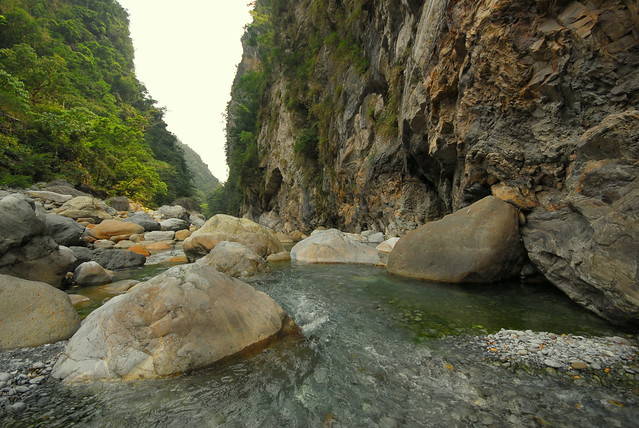
Taroko Gorge-Most Beautiful Canyons of the World

Taroko Gorge


Situated near the rocky east coast of Taiwan, Taroko Gorge is one of the island’s biggest tourist attractions. The canyon is 19 kilometer long and offers a number of different hiking trails through breathtaking scenery of spectacular cliffs and white-water rapids.
Taroko Gorge (太魯閣: Tàilǔgé) [1]) is an impressive 19-km-long canyon, situated near Taiwan's east coast. The area of the gorge is also identified as Taroko Gorge National Park (太魯閣國家公園; Tàilǔgé gúojiā gōngyuán).

The Taroko Gorge is composed mainly metomorphic rocks, such as marble,gneiss, "schist",etc. The name, Taroko, means the "magnificent and splendid" in the language of Truku, the aboriginal tribe who resides in the area.

[edit]History

When Taroko National Park [2] was eventually established on November 28, 1986, it was of special significance for the environmental protection movement in Taiwan: it showed that both the public and the government agencies had realized despite the nation's four decades of extraordinary economic success, serious damage was being done to its natural resources. According to the National Park Act of the Republic of China (passed in 1972), parks are established to protect the natural scenery, historic relics and wildlife; to conserve natural resources; and to facilitate scientific research and promote environmental education.

[edit]Landscape

The most phenomenal aspect of the park is the amazing relief. In a single afternoon you can travel from rugged coastal cliffs through a maze of subtropical forested canyons to high elevation subalpine coniferous forests.
In about 60 kilometers the landscape rises from sea level to some of the tallest peaks in Taiwan at over 3400 meters. That's steep!
The force behind the steep valleys and narrow canyons is a (geologically speaking) relatively fast rate of uplift combined with ample water. Over the last 70 million years, these two forces collaborated to form the world's deepest marble canyon. The slot canyons here are remarkable with narrows sections a thousand feet high and only a dozen yards apart, reminiscent of the Virgin River in Zion National Park in Utah, USA. Ignore the fact that Zion is in the desert, and made of sandstone and Taroko is subtropical and comprised of marble, and these two gorges have a lot in common.

[edit]Flora and fauna

The park has 144 species of birds 10 percent of which are indigenous to Taiwan. It also hosts over 30 large species of mammal including deer, boar, and bear. 251 species of butterflies, 32 species of reptile and 18 species of fish are also known but considering the rugged terrain of the park, this is probably only a fraction of the species that actually live in the park.

[edit]Climate

The climate is subtropical and generally mild. Rainfall is abundant year round so be prepared and be especially cautious about entering the gorge during typhoons or periods of extended heavy rain due to the danger of landslides and rockfall.
According the the Taiwan Central Weather Bureau, average temperatures at low elevations in the park range from 14 degrees Celsius in January to 27 degrees Celsius in July. At higher elevation it is much cooler with winter temperatures at 2000 meters being about 5.5 degrees C in the winter and 17.5 degrees in the summer and at 3400 meters at the top of Hehuan, temperatures average -3 in January and 9 in July.

[edit]Get in

The nearest major city is Hualien. Flights and trains are available from Taipei and most major cities.

[edit]By bus

From Hualien, bus departs from the train station at 6.30am (to Luoshao), 8.40am (to Lishan), 10.50am (to Tiansiang) and 1.50pm (to Tiansiang). After that, no bus is running anymore. All buses stop at Tzuchi Vihara, Sincheng Taroko Station (太魯閣火車站), Taroko Visitor Center (park entrance), Shakadang (砂卡礑) and Buluowan (布落灣). Although the distance is not large, this bus should take at least 2 hours to Tiansiang, due to very frequent stops and reduced speed inside the gorge. Price: about 170NTD. No change is given, so be sure to bring the exact amount.
In 2010, the Taiwan Tourism Office began running a Tour Taiwan (台灣好行) Taroko Bus departing from Hualien train station, stopping at Sincheng station, Taroko Tourist Information Centre (太管處), Shakadang Trail (砂卡礑), Buluowan (布洛灣), Swallows Grotto (燕子口), Tunnel of Nine Turns (九曲洞), Lushui (合流.綠水) and finishing at Tiansiang (天祥). The service is free until the end of 2010. On weekdays, there are 8 buses per day, departing from 6.50am from Hualien with last bus leaving Hualien at 3:00pm. From Tiansiang to Hualien, buses begin at 8:20am with last bus leaving Tiansiang at 4.30pm. The buses run hourly [http://www.taroko.gov.tw/English/?mm=5&sm=3&page=4#up ]. Additional services run on weekends. The Tour Taiwan bus stops are red in colour with the 'Tour Taiwan' logo. They are placed in prominent locations at the pick up/drop off locations. Make sure you are standing on the right side of the road and hail at the bus if you wish to get on. In 2011, this service seems to have been discontinued. In 2012, this service has been resumed. 1-day unlimited pass is NT$250, 2-day unlimited pass is NT$400. As of October 15, 2012, Shakadang Trail and Tunnel of Nine Turns have been closed due to typhoon damage; it is a good idea to ask the information center about a good tour path.

[edit]By train

A journey by train from Taipei to Hualien takes 2 hours by express train (440NTD) and 3 to 4 hours by local trains. The trains are cheap, reliable and comfortable. Station names are announced in English and Chinese so you should have no problem identifying your stop. The closest train station to the park entrance is Sincheng (新城). From there, there is the choice of a one way taxi ride from the station to Taroko for about NT$200 or a day tour costing about NT$2,000.
The Tour Taiwan (台灣好行) Taroko Bus picks up and drops off at both Singcheng (新城) station and Hualien station.

[edit]By taxi

A taxi from the Hualien train station to Tiansiang (town in Taroko National Park, where the Grand Formosa hotel is located) costs about NT$1200 and takes about 1 hour.

[edit]By scooter

You can rent a scooter near the train station in Hualien. It takes around 30min to reach Taroko Gorge. However in some cases you may need a local drivers license to do so. You can also rent a scooter by the Xincheng train station, which is closer to the park. The price quoted in April 2012 was NT$500 per day. An American or European drivers license (and possibly other countries as well) and a passport will suffice at this shop.

[edit]Fees/Permits

Entry to the park is free but if you want to go to some of the wilderness or into areas designated as Eco-protection areas or restricted mountain areas, you will need an entry permit. Be sure to apply for the permits early (at least 1 week before) as some permits are limited by a small number per day. Refer to the official Taroko National Park information website for application procedures: http://www.taroko.gov.tw/English/

[edit]Get around

[edit]By bus

There are numerous bus tours visiting the gorge every weekend. And, while the buses are comfortable and air-conditioned, the tours tend to have a tight itinerary (including, of course, the obligatory stop at some local gift shop), leaving little time for extended hiking. Tour buses leave from the Hualien visitor information center and cost about NT$988 per person for a whole day tour.
There is also a non-tourist bus that brings passengers to and from Tiansiang. However, it goes pretty fast around some sharp turns along steep cliffs. If you get car sick easily or are afraid of heights, you might want to pass on this bus. From Tiansiang, buses depart to inside the gorge at 8am to LuoShao (洛韶) and 10.05 to LiShan (梨山). Starting from Tiansiang (169.5km of highway 8; altitude: 480m), the bus to Lishan runs through Wenshan (167km, 575m), Huitouwan (163.4km, 750m), Xibao (161.4km, 915m), Luoshao (洛韶, 154km, 1117m), Xinbaiyang (143km, 1644m), Ci'en (132.8km, 1995m), Bilü Sacred Tree (128.3km, 2150m), Guanyuan (117.3km, 2374m), Dayuling (112.5km, 2565m), Lishan (1800m). The bus to Lishan arrives there at 1pm, and departs from Lishan to Tiansiang at 3pm. Buses from Tiansiang depart to Hualien at 9.10, 14.00, 16.40 and 18.00. Price: about 170NTD. Don't forget to bring enough coins as no change is given.
There is (or has been?) also a free shuttle bus which you can take from outside the Visitors Centre near the Train station. This runs all the way to Tiansiang and you can get off and on at about 10 stops. The timetable is available from the Visitor's Centre. It runs approximately every hour from about 8:00 to 17:00 [though not on the hour]. There are a few extra services at weekends. This bus does not seem to run in 2011. This bus has started running again in 2012 but gets fairly crowded at the end of the day when everyone wants to leave. It costs NT$250 for a 1-day unlimited use pass or NT$400 for a 2-day pass.

[edit]By car

Renting a car in Hualien is definitely an option, though be very cautious; the roads through the gorge are extremely narrow with numerous bends. In addition, there are pedestrians, scooters, cars and massive tour buses all vying for the tight space.

[edit]By scooter

The Gorge is not the best place for a first scooter experience. However, it's a fantastic place to ride for those with experience. Scooters are available to rent in Hualien. If you run low on fuel, the locals often stock a small supply that they'll part with for a miraculously uninflated price. There is also a gas station 50km passed Taroko on the number 8 road (around kilometer 118). The drive there climbs to an impressive 3 km altitude. Bring warmer clothes and rain gear. Also make sure to get a helmet with a rain visor. You can rent a scooter from Pony near the train station in Hualien (around NT$400/day)

[edit]By bicycle

For the truly adventurous, cycling is a wonderful way to traverse the park.You can rent a bike just in front of the entrance of the Taroko national park. It costs NT$250 for a day.

[edit]By foot

If you do not have any of the above you can see some parts of the national park by foot. The closest hiking trail to the park entrance is the Shakadang Trail, which departs from the road after the first tunnel approximately 1 km from the park headquarters. The eternal spring shrine is only 1.4 km further trough the tunnels. Taking this tour takes about 4-5h, don't forget to take enough water with you.

[edit]By hitchhiking

Although Taiwan is not a hitchhiking paradise, it is pretty easy to hitchhike in the Taroko gorge and, more generally, on Highway 8, especially if you are a foreigner.

[edit][add listing]See

  • The Eternal Spring Shrine (長春祠)
Drive from the west exit of the Changchun Shrine Tunnel of Central Cross-Island Highway, then turn south to Liwu River Valley, you can see the Changchun Shine (Eternal Spring Shrine) which recognizes the personnel died during the construction of Central Cross-Island Highway. Rivers adjacent to the Changchun Shine become the scattering falls, and the Highway Bureau named it after "Chanchun Falls" which is now the significant landmark on Central Cross-Island Highway.

In 1987 the cliffs of the rivers tumbled and destroyed the pavilion nearby the Changchun Shine. After 10 years it has been restored and now open to the public agagin. In the back of the Changchun Shine , there are stairs leading to Kuanyin Caves, Taroko Tower , Bell Tower , and through a hanging bridge, so called "Heaven trail" to Changuang Temple. The river valley next to the Changuang Temple has a calabash shape, and it is named thereafter as Calabash Valley (Hu-lu Gu).

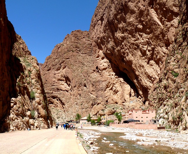
Todra Gorg- Beautiful Canyons of the World

Todra Gorge


Todra Gorge is situated on the remote east side of the High Atlas Mountains and is one of the popular tourist attractions in Morocco. The final 600 meters of the Todra Gorge are the most spectacular as the canyon narrows to a flat stony track as little as 10 meters (33 ft) wide in places with sheer and smooth rock walls up to 160 meters (525 ft) high on each side.
Todgha Gorge is a canyon in the eastern part of the High Atlas Mountains inMorocco, near the town of Tinerhir. Both the Todgha and neighbouring Dades Rivers have carved out cliff-sided canyons (Arabic: wadi) on their final 40 kilometres (25 mi) through the mountains. The last 600 metres (1,969 ft) of the Todgha gorge are the most spectacular. Here the canyon narrows to a flat stony track, in places as little as 10 metres (33 ft) wide, with sheer and smooth rock walls up to 160 metres (525 ft) high on each side.

The tiny glacier stream is something of a misfit, the river which once filled the gorge must have carried a lot more water. It is easy to hike in the gorge along a well-maintained paved road. The scenery is spectacular. Local people live in the area and can be seen with their small donkeys or herding camels and goats.
The area is no longer as remote as it once was. A well-maintained asphalt road leads up the valley from Tinerhirto the gorge. A concrete road continues up the valley, past the hotels at the mouth of the gorge all the way to the villages of Aït Hani, Tamtatouchte, and Imilchil.
Thanks to its robust rock sides with many uneven surfaces, todgha Gorge is popular among rock climbers. More than 150 routes rated French Grade 5+ to 8 have been bolted in the canyon.

Monday, 29 October 2012

Sun Temple, Konark

Sun Temple, Konark


The Sun temple in Konark in the state of Orissa was built by King Narasimhadeva in 13th century. This magnificent temple to Surya, the Sun God, is one of India’s architectural wonders and a UNESCO World Heritage. 

Built on the shores of the Bay of Bengal in Orissa, its main image is a superb statue of the sun god standing on his chariot. Twelve superbly carved wheels, each representing a month of the year and seven stone horses, representing the days of the week, pull the sun god in his journey across the skies. The temple is covered with exquisite sculptures of beautiful maidens, erotic couples, dancers, deities and animals. It is a magnum opus of Orissa’s architectural grandeur. The drive along the seashore from the temple town of Puri to Konark is delightful. 


The wheels of the chariot at the base of the temple are the main attraction of the Sun Temple. The shadow created by the spokes of the wheel act as sundials and gives the exact time of the day. The roof of the temple which is pyramid shaped is made from sandstone and is about 30m in height. 

The temple walls are adorned with floral, geometrical, human, animal, divine and semi divine figures. Pair of monolithic elephants and horses depicts the dynamism of medieval sculpture. 

This temple is also referred as the Black Pagoda, since it was built in black granite. The Sun temple looks magnificent even in its ruined state. Only a personal visit to Konark gives a clear picture of the imposing yet exquisite temple. 


Shimla

Shimla 


Location - Situated in the north-west Himalayas, Shimlais the capital of Himachal Pradesh. 
Shimla was the most important British hill resort, prior to India's independence. It is named after its patron goddess, Shamla Devi, amanifestation of Kali. Shimla, located at an altitude of 7,267 feet, is inhabited around a crescent - shaped ridge, which is blessed with perennially cool air and amazing views. It provides superb panoramic sights of the valleys, and the lofty peaks of the great Himalayan range, on both sides. The colourful local bazaars of Shimla are sprawled over the southern slopes of the ridge. 

Spread across 12 kms along a ridge that overlooks terraced hill sides and cultivations, Shimla is magnificently robed in dense forests of oak and pine, fur and rhododendron, and it is best to travel here on the slow train from Kalka. Shimla also is a convenient base for variety of adventure sports such as Skiing, Trekking, Fishing and Golfing etc. 

Places of Interest :

» Gaiety Theatre - This theatre is one of the oldest theatres in the world. It is on the Mall Road. Famous plays are often staged here.

» Himalayan Bird Park - Situated 1km from the Mall Road, in this park one finds rare birds. Models of some endangered species (animals and birds) are also found here.

» Viceregal Lodge - This hall is the most beautiful building in Shimla. It houses some of the most ancient articles that would take us back to the times of the British rule. 

» Jakhu Hill - Shimla's highest Peak, this is situated 2km from the town. One can have a breathtaking view of Shimla from here. A Hanuman Temple is also found on this peak.

» Chadwick Falls - 7km from Shimla, this is an ideal picnic spot. At 1,586 meters above sea level, it is surrounded with waterfalls.

» Summer Hill - Another picnic spot 4 kms. from Shimla, it is located at 1,851 meters above sea level. It has a beautiful temple of Goddess Taradevi. 

» Prospect Hill - Located on this hill isthe temple of Goddess Kamna. Sunrise and the moon are spectacular sights from here. A 15-minute climb from Baluganj would bring you here. For those interested in the culture and art of Himachal Pradesh, here is a State Museum.

» Kufri - 16km from Shimla, beautiful Kufri is alsocalled the "Chinese Bungalow". Many games are organised here from February to March. In winter one can ski on its snow-covered slopes and inthe summer have a ride on the back of the Yak. Kufri is well known for its natural scenic beauty.
Chail Himalaya Temple !!!
» Chail - Another scenic spot where the river A saniflows. This adds to its beauty. The world's highest cricket field is situated here. A story goes that due to some differences, the British hadfor bidden the Maharaja of Patiala from going to Shimla. Therefore, he laid the foundation for the town of Chail and since he loved the game of cricket,a field was specially laid. Chail is about 45 kms from Shimla. 

» Nalderao - 22 kms from Shimla, it has the oldest golf course in India. The pine and deodar add to its beauty.

» Fagu - It is located 2,510 mts. above sea level.Winter is extremely beautiful here. Dense forests and apple orchards have their unique attraction. The snow-capped mountains can hold anyone spell-bound.
Shimla Temperature !!!Shimla Temperature !!!How To Get There?

» By Air - The airport is at Jubbarhatti, 23 kmaway. 
» By Rail - Shimla is connected to Kalka by anenchanting narrow guage railway line - where even a quaint rail-car plys. 
» By Road - By road, Chandigarh is 117 km, Manaliis 219 km, Chail is 45 km and Delhi is at a distance of 370 km. From Delhi,the driving time is about eight hours. From Delhi, Manali and Chandigarh,Luxury coaches and taxis ply to Shimla


Temperature : 

ClimateMaxMin
Summer33°4°
Winter18°1°


Distance from towns and cities :

Cities / TownsKms.
Amritsar342
Chandigarh116
Delhi343
Dharmasala280
Chamba502
Jammu848
Kulu240
AmbalaKalka151
Manali89
 280 173

Wednesday, 24 October 2012

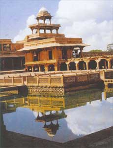
Fatehpur Sikri, Agra


Fatehpur Sikri, Agra 


In honour of saint Shaikh Salim Chishti, the Mughal emperor Akbar, the great, founded a magnificent city on Sikri ridge. In 1571 he ordered the construction of buildings for his own use and asked the noblemen to built houses for themselves. Within a year, most of the work was finished and within the next few years, a well planned city with administrative, residential and religious buildings came into existence.
The Jami Mosque was perhaps among the first buildings to come up. Its epigraph provides AH 979 (AD 1571-1572) as the date of its completion. The Buland ­Darwaza was added some five years later.
Among other important buildings are the tomb of Shaikh Salim Chishti, the Naubat-or-Naqqar Khana (drum-house), Taksal (mint), Karkhanas (royal workshops), Khazana (treasury), Hakim's quarters, Diwan-i-Am (hall of public audience), house of Maryam also called Sunahra Makan (Golden House), palace of Jodha Bai, Birbal's house etc.

Fatehpur Sikri was Akbar's capital for approximately 12 years. Akbar selected Sikri as the seat of his government believing it to be auspicious for himself. He experimented both with architecture and art and built a city expressing his ideals and vision. Today, Fatehpur Sikri is a deserted, phantom city. But the inner citadel is immaculately preserved. The finest monuments within this area are the Diwan-i-Am, Diwan-i-Khas, Panch Mahal, Buland Darwaza and the tomb of Saint Sheikh Salim Chishti, and the Jama Masjid (one of the largest mosques In India).

Timings: 9.00 a.m - 6.00 p.m
Open on all weekdays

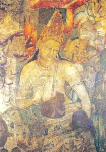
Ajanta Caves

Ajanta Caves


The world famous Ajanta Caves including the unfinished ones are thirty in number, of which five (9, 10, 19, 26 and 29) are chaitya-grihas and the rest are viharas (monasteries). After centuries of oblivion, these caves were discovered in AD 1819. They fall into two distinct phases with a break of nearly four centuries between them. All the caves of the earlier phase date between second century BC-AD. The caves of the second phase were excavated during the supremacy of the Vakatakas and Guptas.
A few paintings, which survive on the walls of Caves 9 and 10date back to the second century BC-AD. The second group of the paintings started in about the fifth century AD and continued for the next two centuries as noticeable in later Caves. Caves 1, 2, 16 and 17 have remarkable paintings with themes intensely religious in tone and centre around Buddha, Bodhisattvas, incidents from the life of Buddha and the jatakas. The paintings are executed on a ground of mud-plaster in the tempera technique.
By Air:
Currently Aurangabad is the nearest Air point for Ajanta. It can be reached from New Delhi and Mumbai (Bombay), international airport. Indian airlines as well as Jet Airways have daily flight to Aurangabad from New Delhi and Mumbai.
Jalgaon has also developed its Airport. Soon it will also start. Ajanta Caves is far near from Jalgaon Airport while a bit distant from Aurangabad Airport.

By Rail: 
Jalgaon is the best place to drop in for Ajanta if you like Rail journey. It is centre point of all major railway stations of India and has Bhusaval (Just 28kms from Jalgaon) as Second largest depot of railways in entire Asia.
All Super Fast, express, mail and passenger trains stops at Bhusaval and most of them at Jalgaon as well. You can check online status of availability of reservation on Indian railways official website. From Jalgaon, you can pick up Taxi/ state transport department bus to reach ajanta.
Cave Timings: 
9.00AM to 17.30PM Indian Standard Time (IST)
Ajanta Caves remain closed on Monday. CAVES REMAIN OPEN ON ALL NATIONAL HOLIDAYS

Cave Charges: 
1. For Indians below 15 years : FREE of Charge
2. For Indians above 15 years : Rs. 10/- per head 
3. For Foreigners above 15 years : US $5 or equivalent in Indian rupees per head
4. For Photo Camera/ Video Camera: Rs. 5/- (Camera to be used without flash
) 

Agra Fort, Agra


Agra Fort, Agra 


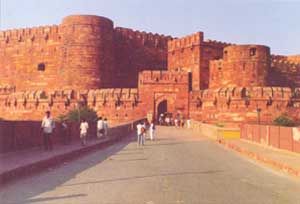
Agra Fort represents the first major building project of Akbar, with remains of only a few buildings built by him which now survive. Built on the site of an earlier castle in AD 1565-1575, the fort, apart from other important units, contains Jahangiri Mahal, Khass Mahal, Diwan-i-Khass, Diwan-i-Am, Machchhi Bhawan and Moti Masjid. Many extant buildings were erected by Shah Jahan (AD 1630-1655). Of its four gates, the most impressive is the Delhi Gate on the west.
A little over 1 km from the Taj, on the same river bank, stands the majestic Agra Fort. Though its history dates from as early as 2500 years, it was only during the reign of Emperor Akbar that the city of Agra reached its apotheosis of glory. During his reign, the main part of the Agra fort was built. Construction of the fort started in 1156 and was finished in 1605. Most of the buildings inside the fortress were erected by Shahjahan.

Timings: 6.00 a.m - 5.30 p.m
Open on all days

Sunday, 21 October 2012

NIAGARA FALLS – ONTARIO ,CANADA


NIAGARA FALLS – ONTARIO

The folks in the City of Niagara Falls in Ontario estimate that Niagara Falls receives more than 12 million visitors every single year. We really weren’t surprised to find that it’s such a popular attraction – it’s one of the most famous in the United States as well. What we don’t do is attempt to determine which side – Canada or the US – gets more visitors.
Hopefully you’ll get to visit at least a few of these great attractions during your Canadian vacation.
Welcome to the Official Website for Niagara Falls, Ontario. Packed with attractions, world-class hotels and dining, exciting nightlife and family adventure, the New Niagara Falls is a vacation paradise. And now it has the planning tool to match! This easy-to-use Niagara Falls Tourism website is full of travel tips and tools to help you plan your stay and make it memorable. What’s your perfect Niagara Falls getaway?
The New Niagara Falls, Canada-with eclectic restaurants, contemporary hotels, and electrifying attractions-is a true Canadian vacation destination for couples and families alike. Grown ups have upscale hotels, modern casinos, nightlife and concerts, fine dining, golf courses and spas, and wine country is just down the road. For children, Niagara Falls is a veritable theme park with ultra tall buildings (Skylon Tower), water parks inside hotels, Ferris wheels and kid-friendly restaurants (Clifton Hill), and we even sneak in some education at Niagara Falls attractions like the Butterfly Conservatory and Marineland. Let’s not forget the Falls.
From the Maid of the Mist to Journey Behind the Falls, there are plenty of ways to experience this great wonder of the world. Situated just 20 minutes from Buffalo International Airport and an hour from the Toronto area, a Niagara Falls vacation is easy to get to and fun to plan. At the end of June 2012 we will be adopting a booking engine to better assist you with planning and customizing your trip to Niagara, we can help you choose your Niagara Falls hotels , attractions, shopping coupons and gift certificates for the best places to eat in Niagara, that pulls together the perfect itinerary for you.
Start your trip at Niagara Falls Tourism. We’ll introduce you to this new Ontario vacation destination through our signature experiences.  Of course a trip to Niagara wouldn’t be complete without a visit to Niagara Falls, but did you know that there are over 12 themed vacations you can enjoy:  Golfing, exploring, thrill seeking, rejuvenation, and shopping.  Do you love exploring the Niagara Wine trails, or sampling the best Niagara entrees and desserts that are simply delicious?  Looking for family fun experience in Niagara or are you looking for a romantic Niagara getaway, whatever your best vacation ideas are we can fulfill them.  Check out our experience page for more details on the Niagara Culinary experience, the Niagara Thrill Seeking experience and much more.